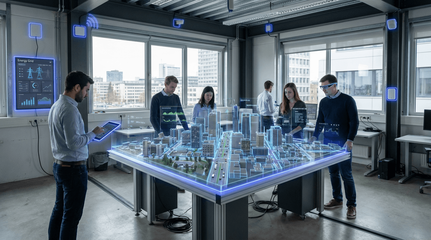
Urban Digital Twins
Urban digital twins represent a sophisticated convergence of geographic information systems, Internet of Things sensors, and advanced simulation technologies that create dynamic, three-dimensional virtual replicas of entire cities. Unlike static maps or traditional planning models, these digital twins continuously ingest real-time data from thousands of sensors embedded throughout the urban environment—monitoring everything from traffic patterns and energy consumption to air quality and structural integrity of buildings. The technology relies on a complex architecture that combines building information modeling (BIM), geospatial data, and machine learning algorithms to maintain an accurate, constantly updating mirror of the physical city. This digital representation captures not just the static geometry of buildings and infrastructure, but also the dynamic flows of people, vehicles, utilities, and environmental conditions that define urban life.
The fundamental challenge these systems address is the inherent complexity and risk of urban decision-making. City officials have traditionally relied on historical data, static projections, and limited pilot programs when making decisions that affect millions of residents and billions of dollars in infrastructure investment. Urban digital twins transform this paradigm by enabling consequence-free experimentation and scenario testing. Planners can simulate the ripple effects of a new transit line, test how proposed building developments might affect wind patterns and microclimates, or model evacuation routes under various disaster scenarios. This capability dramatically reduces the uncertainty inherent in urban planning decisions, allowing cities to identify potential problems before they manifest in the physical world. The technology also enables more responsive governance by revealing inefficiencies in real-time—whether that's identifying underutilized public spaces, detecting infrastructure failures before they become critical, or optimizing traffic signal timing to reduce congestion and emissions.
Early implementations have emerged in several forward-thinking municipalities, where digital twin platforms are being deployed for specific use cases ranging from construction coordination to energy grid optimization. These systems are proving particularly valuable for climate adaptation planning, as they allow cities to model flooding scenarios under different rainfall intensities or simulate the urban heat island effect under various greening strategies. The technology also supports more inclusive planning processes by providing stakeholders with intuitive visualizations of proposed changes, making complex urban systems more comprehensible to residents and community groups. As computing power continues to increase and sensor networks become more ubiquitous, urban digital twins are expected to evolve from specialized planning tools into core operating systems for city management, fundamentally changing how municipalities understand, manage, and evolve their built environments in an era of rapid urbanization and climate uncertainty.
Related Organizations


A dynamic 3D city model and collaborative data platform, including the 3D maps of Singapore.

Generates a semantic 3D digital twin of the entire Earth using satellite imagery and AI.

A partnership between the University of Cambridge and the UK government.

Software corporation specializing in 3D design and digital mock-ups.

Provides 3D digital twins of cities to assist in the planning application and assessment process.

Hexagon AB
Sweden · Company
A global leader in sensor, software, and autonomous solutions, providing reality capture for digital twins.

Developing foundation models for robotics (Project GR00T) and vision-language models like VILA.

A subsidiary of Engie, providing 3D city modelling and simulation for telecommunications and smart city planning.