Border & Maritime Domain Awareness
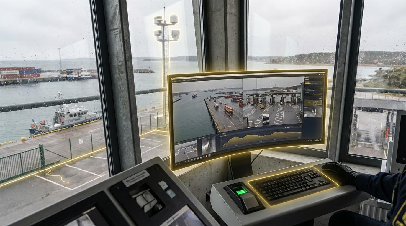
Border and maritime domain awareness represents a comprehensive approach to monitoring and securing vast territorial boundaries and oceanic zones through the integration of persistent surveillance technologies and artificial intelligence-driven analysis. This capability combines high-altitude platforms such as aerostats, stratospheric balloons, and long-endurance unmanned aerial vehicles with maritime autonomous systems including surface vessels and underwater drones to maintain continuous observation over areas that would be prohibitively expensive or operationally challenging to monitor through traditional means. The technical foundation relies on multi-sensor fusion, integrating electro-optical cameras, infrared sensors, synthetic aperture radar, and automatic identification systems to create a unified operational picture. Advanced AI algorithms process these multiple data streams in real-time, applying pattern recognition and anomaly detection to distinguish routine maritime traffic from potentially suspicious activities, while machine learning models continuously refine their understanding of normal baseline behaviors across different geographic zones and temporal patterns.
The strategic imperative for enhanced border and maritime awareness stems from the increasing complexity of security challenges facing nations with extensive coastlines and maritime interests. Traditional patrol methods struggle to provide adequate coverage across the millions of square kilometers that constitute exclusive economic zones and territorial waters, creating gaps that can be exploited for illegal activities ranging from smuggling and human trafficking to unauthorized fishing and potential hostile incursions. The sheer volume of legitimate commercial shipping—with tens of thousands of vessels transiting major chokepoints daily—creates a needle-in-haystack problem that overwhelms human analysts. AI-ranked risk triage addresses this challenge by automatically prioritizing alerts based on multiple factors including vessel behavior, transponder anomalies, known threat patterns, and contextual intelligence, allowing security personnel to focus their limited resources on the highest-probability threats. This capability proves particularly valuable in monitoring critical infrastructure such as offshore energy installations, undersea cables, and strategic waterways where early detection of anomalous activity can prevent significant economic or security consequences.
Current deployments of integrated border and maritime domain awareness systems are expanding globally, with several nations implementing pilot programs that combine satellite imagery, coastal radar networks, and autonomous platforms into unified command centers. These systems have demonstrated measurable improvements in interdiction rates while simultaneously reducing the operational costs associated with maintaining constant physical patrols. The technology shows particular promise in addressing the challenge of "dark vessels" that disable their transponders to avoid detection, using radar and optical signatures to maintain tracking even when cooperative identification systems are compromised. Looking forward, the integration of space-based sensors, improved AI models capable of predicting vessel destinations and detecting coordinated suspicious behaviors, and enhanced data-sharing frameworks between allied nations points toward a future where maritime domain awareness becomes increasingly comprehensive and collaborative, fundamentally reshaping how nations protect their sovereign waters and international shipping lanes.
Related Organizations

Provides commercial Synthetic Aperture Radar (SAR) satellite data.

Manufactures and operates autonomous surface vehicles (USVs) powered by wind and solar for ocean data collection.

Predictive maritime intelligence platform using AI to analyze behavioral patterns of ships.

Uses satellite technology and machine learning to visualize global fishing activity.


Uses a constellation of nanosatellites to collect radio occultation data, fed into ML models for forecasting.

Specializes in space-based RF detection for maritime surveillance.

Provides software for analyzing maritime risks, including biosecurity and illegal fishing.
Supporting Evidence
Research this in Signals
Signals turns a topic into a sourced research record you can inspect and rerun. Your first scan is free, and this one starts with Border & Maritime Domain Awareness already loaded, so edit it or scan as is.