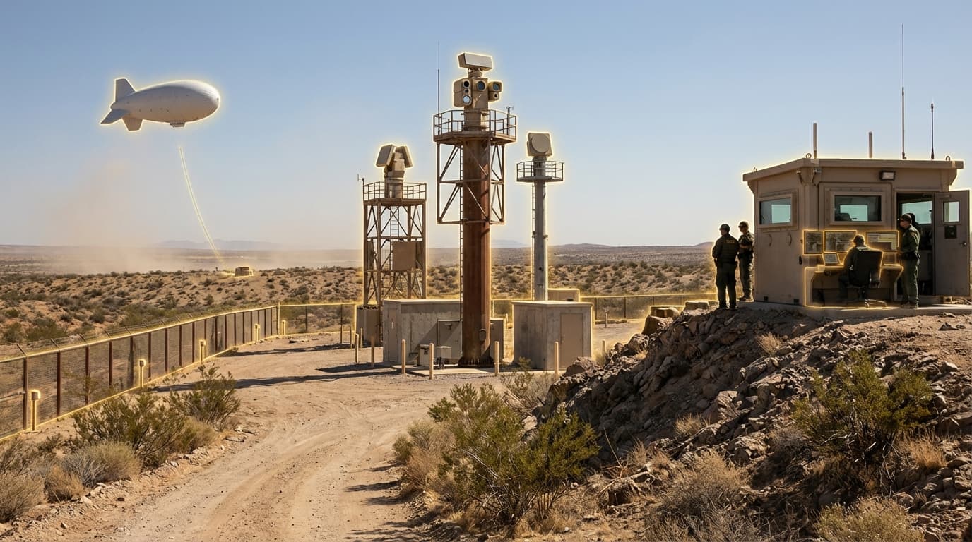
Border Surveillance Networks
Border surveillance networks represent a comprehensive integration of physical sensor infrastructure and artificial intelligence designed to monitor and secure national frontiers across diverse and challenging terrain. These systems combine multiple detection technologies—including radar towers that can track movement across dozens of kilometers, lidar systems that create precise three-dimensional maps of border zones, tethered aerostats that provide persistent elevated observation platforms, and unattended ground sensors that detect seismic vibrations, thermal signatures, and electromagnetic emissions. The data streams from these disparate sources are fused through AI-enabled analytics platforms that filter environmental noise, classify detected objects, and alert operators to potential security events. Unlike traditional border security approaches that relied on periodic patrols and static checkpoints, these networks provide continuous, automated monitoring across vast distances, functioning effectively in extreme weather conditions, complete darkness, and terrain that would be prohibitively difficult for human surveillance alone.
The fundamental challenge these systems address is the impossibility of maintaining constant human presence across thousands of kilometers of remote frontier. Desert regions, mountainous passes, dense forests, and maritime boundaries present unique detection challenges—extreme temperatures can disable conventional electronics, vegetation obscures visual observation, and the sheer scale of modern borders exceeds the capacity of traditional security forces. Border surveillance networks overcome these limitations by creating persistent sensor coverage that operates autonomously for extended periods, reducing the personnel requirements for frontier monitoring while simultaneously improving detection reliability. The AI analytics layer proves particularly valuable in reducing false alarms caused by wildlife, weather phenomena, or legitimate civilian activity, allowing security personnel to focus resources on genuine threats. This technology also enables more sophisticated threat assessment, as machine learning algorithms can identify patterns of behavior, predict likely crossing points based on historical data, and coordinate responses across multiple agencies in real time.
Several nations have deployed large-scale border surveillance networks in recent years, with systems now operational across North American desert frontiers, European maritime boundaries, and Middle Eastern land borders. These deployments typically combine fixed infrastructure in high-traffic areas with mobile or temporary systems that can be repositioned based on evolving threat patterns. The technology has proven especially valuable in detecting organized smuggling operations, as the persistent monitoring reveals patterns that would be invisible to periodic patrols. Looking forward, border surveillance networks are expected to incorporate additional sensor modalities, including hyperspectral imaging that can detect disturbed soil or concealed materials, acoustic arrays that identify vehicle types by engine signature, and satellite integration that extends coverage to the most remote regions. As geopolitical tensions continue to emphasize border security and as AI capabilities advance, these networks will likely become standard infrastructure for nations seeking to balance security requirements with efficient resource allocation across their frontiers.
Related Organizations

Develops Lattice OS, an AI-powered operating system that fuses sensor data to automate command and control across autonomous systems.

Elbit Systems
Israel · Company
Major defense contractor developing AI-driven autonomous swarms (Legion-X) and target acquisition systems.

Manufacturer of thermal imaging cameras and sensors used on monitoring drones.

Develops compact, metamaterials-based beamsteering radar platforms (MESA) for defense and security.

Global leader in Lighter-Than-Air (LTA) persistent surveillance aerostats.

A German defense electronics company that has publicly claimed research into quantum radar technology for stealth detection.

Spanish information technology and defense systems company.

SRC Inc.
United States · Nonprofit
Not-for-profit research and development company.

Software company specializing in geospatial video analytics.
Supporting Evidence
Research this in Signals
Signals turns a topic into a sourced research record you can inspect and rerun. Your first scan is free, and this one starts with Border Surveillance Networks already loaded, so edit it or scan as is.