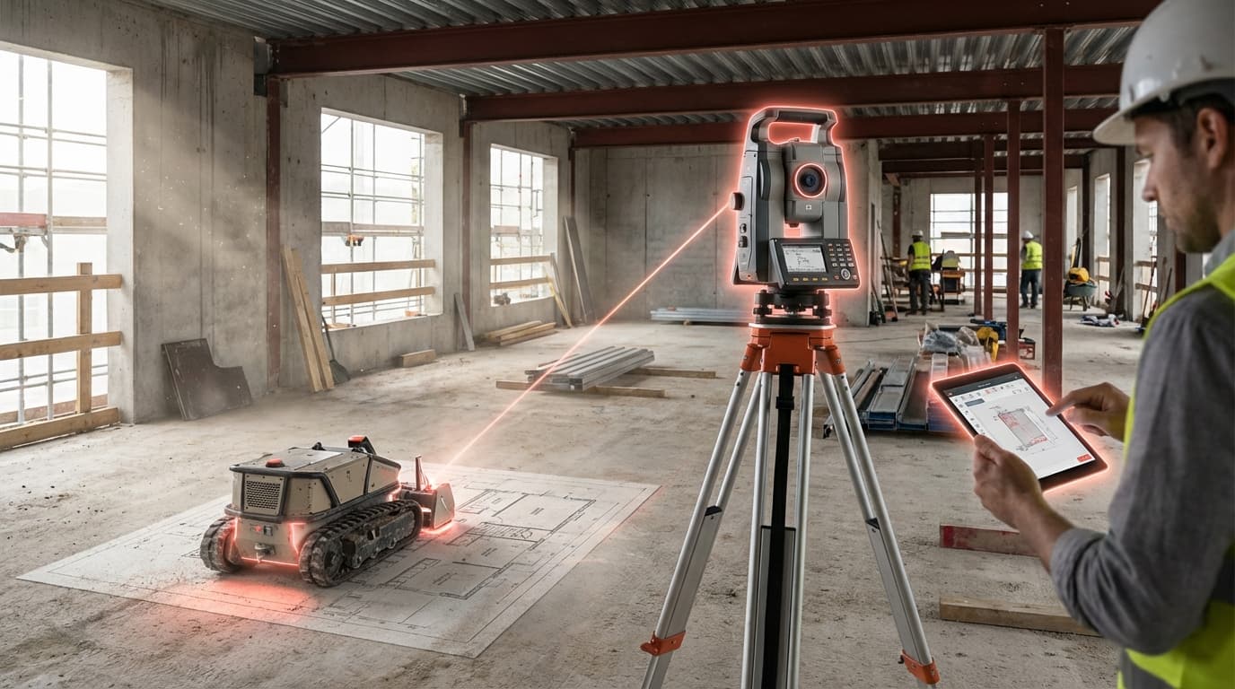
Robotic Site Layout & Total Stations
Construction sites have long struggled with the gap between digital design and physical execution. Traditional layout processes require skilled surveyors to manually transfer measurements from building information models (BIM) to the job site using tape measures, chalk lines, and handheld instruments—a time-consuming process prone to human error. Even small measurement discrepancies can cascade into costly rework, particularly when anchor bolts, wall positions, or mechanical-electrical-plumbing (MEP) penetrations are misaligned. Robotic site layout systems address this challenge by automating the translation of digital coordinates into precise physical markings, eliminating the manual interpretation step that has historically introduced errors into construction workflows.
These systems combine robotic total stations—motorized surveying instruments that can automatically track targets and measure distances with millimeter accuracy—with autonomous mobile platforms that navigate the job site. The technology works by importing three-dimensional coordinates directly from BIM software, then using laser-guided positioning to mark exact locations on floors, walls, and ceilings. Advanced models can spray paint, chalk, or project laser points to indicate where structural elements, utility penetrations, or partition walls should be installed. By maintaining a continuous digital thread from design through execution, these robots ensure that every physical element aligns with the architect's and engineer's intent. The systems typically operate during off-hours or alongside human crews, continuously verifying their own position through integration with building control points and adjusting for site conditions in real time.
Early adopters in commercial and industrial construction report significant reductions in layout time—tasks that once required days of surveyor labor can now be completed overnight by autonomous systems. General contractors are deploying these robots on projects ranging from data centers, where precision is critical for equipment installation, to multifamily residential buildings, where repetitive floor plans benefit from automated workflows. The technology is particularly valuable in complex MEP coordination scenarios, where hundreds of penetrations must be marked with exacting accuracy to avoid conflicts during installation. As construction labor shortages intensify and project schedules compress, robotic layout systems represent a shift toward hybrid job sites where digital models directly control physical execution, reducing the dependency on manual measurement skills while improving overall build quality and schedule predictability.
Related Organizations

Developer of the FieldPrinter, a robot that autonomously prints floor plans and layout lines directly onto concrete slabs.

Develops Tekla Structures, a leading BIM software for structural engineering and steel detailing, along with hardware for connecting BIM to the field.

Develops CivDot, an autonomous surveying robot that marks coordinates for solar farms, roads, and infrastructure.

HP
United States · Company
Partnering with Google to commercialize Project Starline hardware for enterprise meeting rooms.

Rugged Robotics
United States · Startup
Builds rovers that mark architectural and engineering layouts directly onto unfinished concrete floors.

Manufactures the LN-150 Layout Navigator, a simplified robotic total station designed for digital layout.

Construction giant that acquired 'Concrete Sensors' to integrate IoT structural monitoring into their portfolio.

Produces autonomous line marking robots for infrastructure, roads, and sports fields, often used for pre-marking.

BIMPrinter
Belgium · Startup
A robotic system that prints layout lines on the floor using a top-down plotter mechanism.