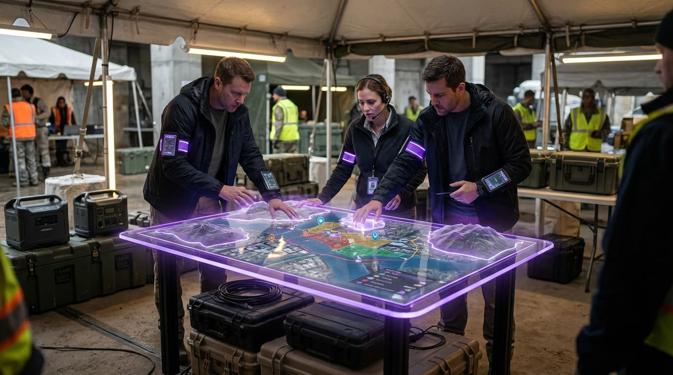
Disaster Response Coordination
When disasters strike, the initial hours are critical for saving lives, yet traditional emergency response systems often struggle with fragmented information, communication breakdowns, and limited situational awareness across multiple agencies and teams. First responders face the challenge of navigating unfamiliar or dramatically altered terrain, assessing structural damage without entering dangerous buildings, and coordinating resources across chaotic environments where conventional infrastructure may be compromised or destroyed. Disaster Response Coordination addresses these challenges through integrated spatial computing systems that synthesise real-time data from multiple sources—including aerial drone surveys, satellite imagery, ground-based sensors, and augmented reality interfaces—into unified, three-dimensional spatial models of affected areas. These systems employ computer vision algorithms to process incoming visual data, identifying structural damage patterns, detecting heat signatures that may indicate trapped survivors, and mapping safe passage routes through debris fields. The technology creates a shared spatial operating picture that updates continuously as new information arrives, allowing emergency management centres, field commanders, and individual responders to work from the same real-time understanding of evolving conditions.
The operational advantages of these coordinated spatial systems are substantial for emergency management agencies and humanitarian organisations. By providing immediate damage assessments without requiring engineers to physically inspect every structure, these platforms accelerate triage decisions and resource allocation during the crucial first response phase. Search and rescue teams equipped with AR headsets can see building stability indicators overlaid on their field of view, along with probable survivor locations based on thermal imaging and structural analysis, significantly improving both efficiency and safety. The shared spatial interface enables multiple agencies—fire services, medical teams, utility companies, and military units—to coordinate their efforts without the communication bottlenecks that typically plague disaster response, as each team can visualise others' positions, assigned sectors, and resource deployments within the same spatial framework. This coordination capability proves particularly valuable in complex scenarios involving hazardous materials, where contamination zones can be precisely mapped and updated as conditions change.
Early deployments of integrated disaster response systems have occurred in earthquake-prone regions and areas affected by severe flooding, where agencies have established protocols for rapid drone deployment and spatial data sharing. These implementations demonstrate measurable improvements in response times and resource utilisation compared to traditional coordination methods. The technology has also found application in conflict zones, where humanitarian organisations use spatial mapping to navigate damaged urban areas and coordinate relief distribution while minimising exposure to ongoing dangers. As climate change increases the frequency and severity of natural disasters, and as urban populations continue to concentrate in vulnerable coastal and seismic zones, the demand for sophisticated spatial coordination tools will intensify. The convergence of increasingly capable autonomous drones, higher-resolution satellite systems, and more intuitive AR interfaces suggests that comprehensive disaster response coordination will transition from specialised deployments to standard emergency management infrastructure, fundamentally transforming how communities prepare for and respond to catastrophic events.
Related Organizations

Creators of C-THRU, an AR visual aid for firefighters that uses computer vision to outline objects in smoke-filled environments.

Provides software that overlays augmented reality information onto live video feeds from drones for public safety and disaster response.

Global leader in GIS software (ArcGIS), providing the spatial analytics layer used by thousands of local governments for urban planning and policy.

International team dedicated to humanitarian action and community development through open mapping.

Developed and operates the EMIT (Earth Surface Mineral Dust Source Investigation) hyperspectral instrument on the ISS.

Provides an intelligent safety platform that links data from connected devices (wearables, apps) directly to 911 and first responders.

Conducts advanced research in humanitarian assistance and disaster relief (HADR) systems, including AI-driven mapping.

Develops photogrammetry software to convert drone images into 3D models and maps.

Creates digital twins of cities to simulate scenarios including disaster response and infrastructure resilience.

The world's largest drone manufacturer, producing consumer and enterprise drones with advanced obstacle avoidance and automated flight modes.