Digital Twin Mobility
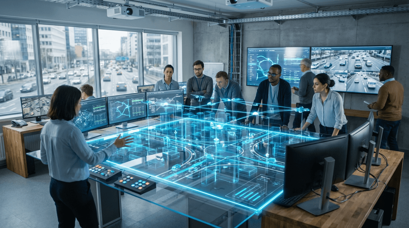
Digital Twin Mobility represents a sophisticated approach to urban transportation management that creates dynamic, virtual replicas of entire transportation networks. Unlike static models or simple traffic simulations, these systems integrate real-time data from multiple sources—including traffic sensors, GPS-enabled vehicles, public transit systems, and even pedestrian movement patterns—to construct a continuously updated mirror of the physical transportation environment. The technology relies on advanced data fusion techniques that combine information from IoT sensors, cameras, connected vehicles, and mobile devices to create a comprehensive digital representation. This virtual model doesn't merely visualize current conditions; it incorporates predictive algorithms and machine learning capabilities that can anticipate traffic patterns, identify potential bottlenecks before they occur, and model the cascading effects of incidents or infrastructure changes across the entire network.
The fundamental challenge this technology addresses is the reactive nature of traditional traffic management systems, which typically respond to congestion after it has already formed. Cities worldwide struggle with the complexity of modern multimodal transportation networks, where changes in one area can trigger unexpected consequences elsewhere. Digital Twin Mobility enables transportation authorities to shift from reactive to proactive management by testing interventions in the virtual environment before implementing them in the real world. This capability proves particularly valuable for evaluating the impact of new infrastructure projects, optimizing signal timing across entire corridors rather than individual intersections, and coordinating responses to special events or emergencies. The technology also supports more sophisticated approaches to managing the integration of emerging mobility services—such as ride-sharing, micro-mobility options, and autonomous vehicles—into existing transportation networks without disrupting overall system performance.
Early implementations in several metropolitan areas have demonstrated the potential of this approach, with pilot programs focusing on corridor management and special event planning. Transportation agencies are increasingly exploring how digital twins can support long-term planning decisions by modeling the effects of demographic shifts, land use changes, and climate adaptation strategies on mobility patterns. The technology aligns with broader trends toward smart city development and data-driven governance, offering a platform that can integrate transportation management with other urban systems such as energy grids, emergency services, and environmental monitoring. As computational capabilities continue to advance and data collection becomes more comprehensive, digital twin systems are expected to evolve toward increasingly autonomous management capabilities, where AI-driven optimization occurs in real-time with minimal human intervention. This progression represents a fundamental shift in how cities approach transportation planning and operations, moving from periodic adjustments based on historical data to continuous optimization based on current conditions and predictive insights.
Related Organizations


Government agency that has deployed one of the world's most advanced digital twins for transport planning and traffic management.

Software company for traffic planning and transport logistics.
Industrial giant offering intermodal transport solutions and MaaS platforms for transit agencies.

Software corporation specializing in 3D design and digital mock-ups.

Developing foundation models for robotics (Project GR00T) and vision-language models like VILA.

A data platform that models the built environment and human movement patterns to help public agencies make informed decisions.

Global leader in GIS software (ArcGIS), providing the spatial analytics layer used by thousands of local governments for urban planning and policy.

Big Data for Mobility platform providing on-demand analytics for transportation.