Land-Use, Soil Carbon, and Nature Digital Twins
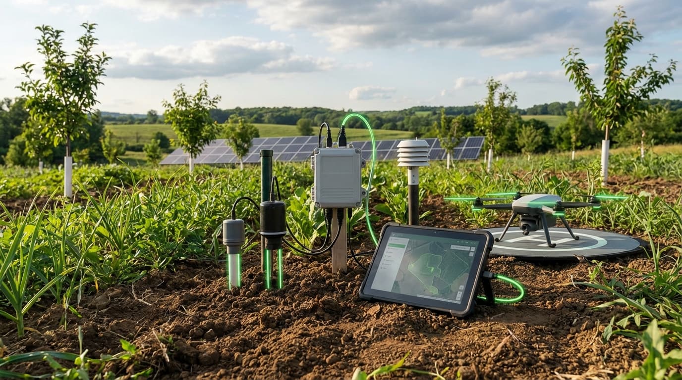
Nature digital twins stitch together lidar, hyperspectral satellites, drone surveys, soil cores, and ecological models to map carbon stocks, habitat quality, and land-use change down to individual parcels. Machine learning harmonizes disparate datasets—forest inventories, crop rotations, grazing intensity—while process-based models simulate how interventions (agroforestry, rewetting, regenerative grazing) affect soil carbon and biodiversity over decades. Users can drag-and-drop scenarios, seeing how buffer zones or mangrove restoration alter carbon sequestration and flood protection.
Landowners leverage twins to qualify for ecosystem-service payments, insurers to price parametric policies, and governments to plan conservation corridors aligned with GBF 30×30 targets. Timber and food companies audit supply chains for deforestation-free compliance, and carbon project developers present digital twin evidence to MRV auditors. Because twins operate continuously, they flag illegal clearing or degradation within days, supporting enforcement.
Technology is TRL 4–5: measuring below-ground carbon and biodiversity remains complex, and data governance with indigenous communities must respect FPIC principles. Initiatives like Nature Tech Collective, Microsoft/Planetary Computer, and UN FAO’s SEPAL are building open standards. As satellite constellations proliferate and AI improves, nature twins will become essential infrastructure for global conservation finance and regenerative land management.
Related Organizations

Uses satellite imagery, remote sensing, and AI to validate and monitor forest carbon projects, creating digital representations of forest carbon stocks.

Develops MRV (Measurement, Reporting, and Verification) software for agriculture, modeling soil carbon sequestration and GHG emissions at the field level.

Provides independent carbon ratings using machine learning and lidar data to assess the quality and permanence of nature-based offset projects.

Uses satellite radar and optical data to measure forest biomass and carbon stock changes directly.

Leads the EAGLE-1 mission and the SAGA program to build a European quantum communication infrastructure in space.

Builds cloud-based operating systems for forest restoration and wildfire resilience, creating granular data visualizations of land health.

Uses environmental DNA (eDNA) to map biodiversity at scale, providing biological data layers for nature digital twins.

A leading provider of global daily earth data, developing the Tanager hyperspectral satellite constellation.
An open data platform connecting global restoration projects with scientific data on local ecology and carbon potential.

Develops handheld hardware and software for in-situ soil carbon measurement to lower the cost of verification.
Supporting Evidence
Research this in Signals
Signals turns a topic into a sourced research record you can inspect and rerun. Your first scan is free, and this one starts with Land-Use, Soil Carbon, and Nature Digital Twins already loaded, so edit it or scan as is.