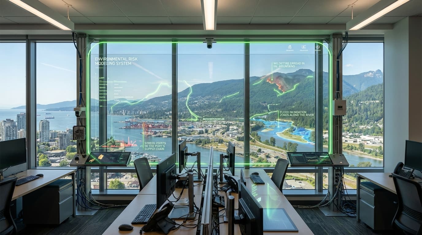
Environmental Risk Modeling
Environmental risk platforms fuse satellite data, radar, IoT sensors, and socio-economic layers to model acute hazards—wildfires, floods, heatwaves—and chronic risks like drought and sea-level rise. Machine learning enhances traditional hydrologic and fire-spread models, delivering sub-kilometer forecasts hours to weeks ahead. Coupled with logistics and commodity data, the same engines quantify how climate shocks ripple through supply chains, ports, and manufacturing clusters.
Insurers use these models for dynamic pricing and parametric covers, utilities for wildfire situational awareness, and cities for real-time flood routing and evacuation planning. Global manufacturers simulate how heat stress might cut factory output or how river levels impact shipping, enabling preemptive inventory moves. Dashboards integrate with emergency operations centers, automatically triggering alerts, work orders, or demand-management campaigns.
TRL 7 tools are in market, but accuracy and liability remain concerns; regulators scrutinize methodologies, and communities demand transparent, bias-aware models. Vendors are moving toward open data standards and third-party validation. As disclosures like TCFD and CSRD require quantified risk assessments, environmental modeling is becoming a must-have for corporate governance and public-sector resilience planning.
Related Organizations
United Kingdom · Consortium
An independent intergovernmental organisation supported by 35 states, actively researching quantum computing applications for numerical weather prediction.

Provides climate risk analytics using cloud computing and AI to model extreme weather risks for asset planning.
United States · Startup
Deploys deep learning AI on mountaintop cameras to detect wildfires in real-time before they spread.
Germany · Startup
Uses thermal-infrared cameras on nanosatellites for global wildfire detection and monitoring.

Developed 'EarthScan', an AI-powered climate intelligence platform to assess asset-level risk across multiple hazards.

Focuses on supply chain resilience by applying AI to climate models to predict impacts on agriculture and logistics.
Uses satellite data and AI to create climate risk models for financial institutions and supply chains.

Uses AI and high-precision terrain data to model flood paths and stormwater runoff for infrastructure planning.

Operates proprietary radar satellites and uses generative AI ('Gale') for weather intelligence.

Descartes Labs
United States · Company
Geospatial intelligence platform automating the analysis of sensor data.
United States · Startup
Reinsurance MGA using deep learning to model wildfire risk with higher accuracy than traditional actuarial models.

Spun out of Cambridge University, providing a platform for companies to assess climate transition and physical risks.
Supporting Evidence
Research this in Signals
Signals turns a topic into a sourced research record you can inspect and rerun. Your first scan is free, and this one starts with Environmental Risk Modeling already loaded, so edit it or scan as is.