Atmospheric Sensing Infrastructure
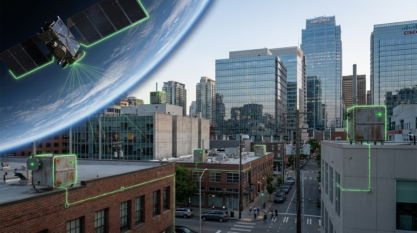
Atmospheric sensing stacks combine hyperspectral nanosat constellations, high-altitude drones, and curbside sensor meshes to measure greenhouse gases, aerosols, and pollutants at unprecedented resolution. Satellites from GHGSat, MethaneSAT, Carbon Mapper, and PlanetiQ detect methane leaks, NOx plumes, and wildfire smoke globally, while city networks deploy low-cost electrochemical nodes and open-path sensors on light poles to monitor street-level air quality. Edge computing and standardized APIs stream data into digital twins, enabling regulators and companies to attribute emissions to specific assets.
Utilities use this infrastructure to verify pipeline integrity, oil and gas majors commit to leak detection and repair schedules, and municipalities enforce clean-air zones in near real time. Insurers and investors subscribe to feeds to assess climate risk, and carbon-credit registries rely on independent measurements to validate offset claims. Paired with AI models, the network can forecast smoke trajectories, issue health alerts, or trigger automatic shutoffs when leak thresholds are exceeded.
The tech is TRL 7 but scaling requires calibration standards, interoperability, and privacy safeguards. Governments are adopting open-data mandates (EU Copernicus expansion, US EPA Methane Rule) and funding sensor deployments in frontline communities to ensure environmental justice. As costs drop, atmospheric sensing becomes a core layer of climate accountability, making emissions as visible—and actionable—as financial transactions.
Related Organizations

Non-profit organization leading a public-private partnership to deploy satellites detecting methane and CO2 point sources.

Specializes in high-resolution remote sensing of greenhouse gas emissions from space.

Pioneers an entirely new way to measure and analyze air pollution and greenhouse gases.
United States · Nonprofit
Major environmental nonprofit that developed and launched MethaneSAT to track global methane emissions.
United States · Startup
Develops continuous methane monitoring cameras for the oil and gas industry to visualize invisible gas plumes.

A leading provider of global daily earth data, developing the Tanager hyperspectral satellite constellation.

Environmental intelligence company using satellite imagery and AI.

Manufactures high-precision gas analyzers and systems for measuring greenhouse gases and trace impurities.

Provides air quality monitoring solutions to cities and businesses.
Germany · Startup
Uses thermal-infrared cameras on nanosatellites for global wildfire detection and monitoring.

A global leader in weather, environmental, and industrial measurements.

Uses a constellation of nanosatellites to collect radio occultation data, fed into ML models for forecasting.
Supporting Evidence
Research this in Signals
Signals turns a topic into a sourced research record you can inspect and rerun. Your first scan is free, and this one starts with Atmospheric Sensing Infrastructure already loaded, so edit it or scan as is.