Quantum Gravity Gradiometers
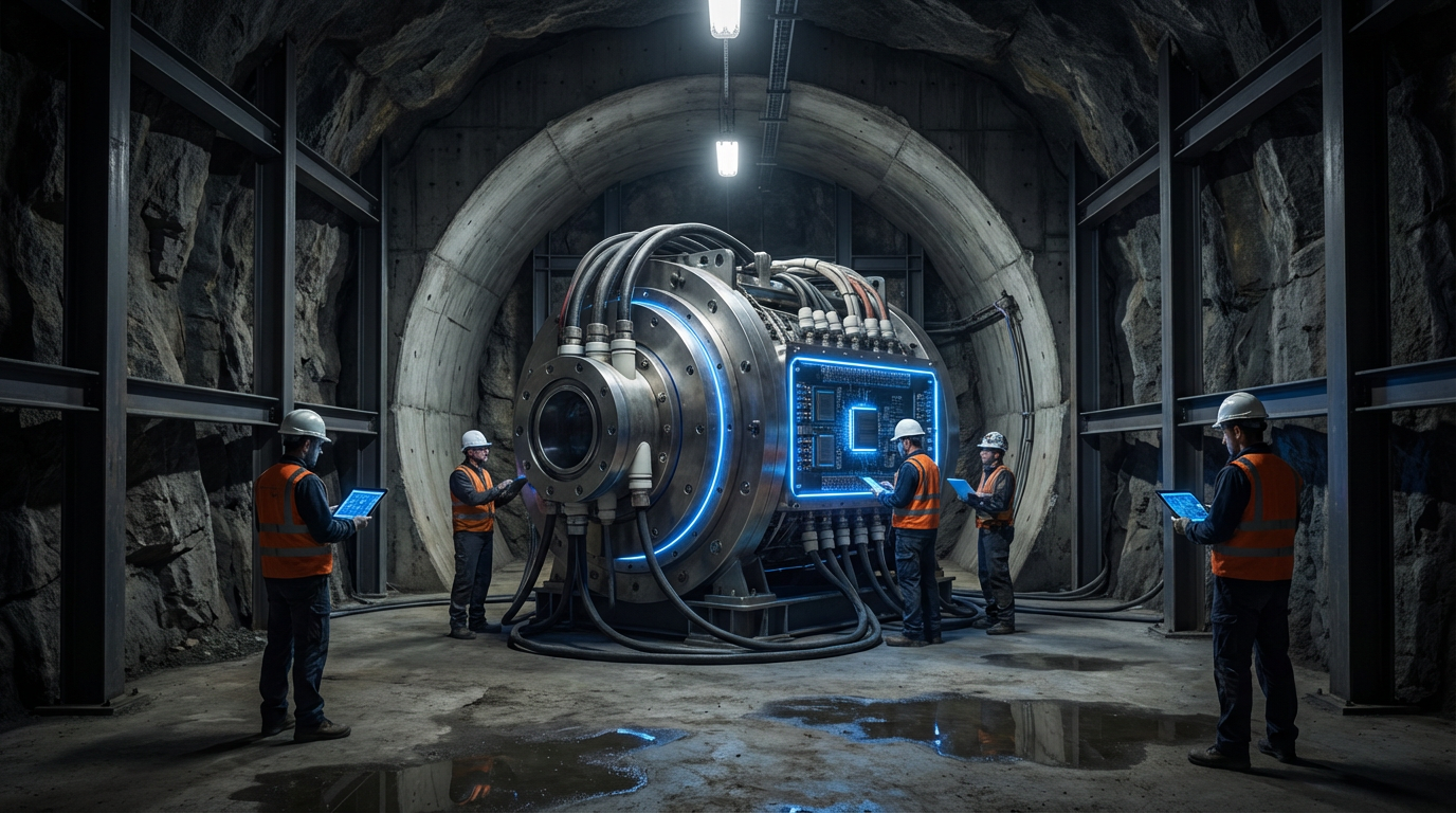
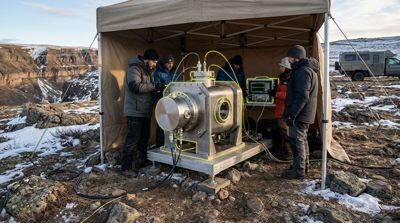
Quantum gravity gradiometers represent a breakthrough in geophysical sensing technology, employing the principles of quantum mechanics to detect extraordinarily subtle variations in Earth's gravitational field. Unlike conventional gravimeters that measure absolute gravity, these instruments measure gravity gradients—the rate of change in gravitational acceleration across space—using cold-atom interferometry. In this process, clouds of atoms are cooled to near absolute zero and manipulated with laser pulses to create quantum superposition states. As these atom clouds fall through the sensor, they act as test masses exquisitely sensitive to gravitational variations. When subsurface features such as ore bodies, voids, or geological structures exist, they create minute density contrasts that alter the local gravitational field. The quantum sensors detect these changes with sensitivity orders of magnitude greater than traditional instruments, capable of resolving variations as small as a few microgals across distances of meters. This quantum advantage stems from the wave-like nature of matter at ultracold temperatures, where atoms behave as precise gravitational probes unaffected by mechanical vibrations or electromagnetic interference that plague conventional sensors.
For the extractives industry, this technology addresses fundamental challenges in exploration efficiency and environmental impact. Traditional mineral exploration relies heavily on extensive drilling programs to confirm subsurface geology, a process that is costly, time-consuming, and environmentally disruptive. Geophysical surveys using conventional gravity meters, seismic methods, or electromagnetic techniques often lack the resolution to definitively identify ore bodies at depth or to distinguish between different rock types with similar properties. Quantum gravity gradiometers overcome these limitations by providing high-resolution three-dimensional maps of subsurface density variations without physical intrusion. This capability enables exploration teams to identify promising targets with greater confidence before committing to drilling, significantly reducing the number of exploratory boreholes required. The technology also excels at detecting voids and cavities, making it valuable for assessing mining safety, identifying abandoned workings, and planning extraction operations. Furthermore, these sensors can operate in challenging environments where traditional methods struggle, including areas with complex geology, urban settings where drilling is restricted, or regions where surface access is limited.
Early deployments of quantum gravity gradiometers have demonstrated their potential in both greenfield exploration and brownfield resource extension projects. Research institutions and technology developers have conducted field trials mapping mineral deposits, underground infrastructure, and geological structures, with results indicating substantial improvements in detection depth and resolution compared to conventional surveys. The technology is particularly promising for identifying deep-seated ore bodies that lie beyond the effective range of traditional geophysical methods, potentially unlocking resources previously considered undetectable or uneconomic. As the sensors become more compact and field-ready, industry analysts note growing interest from major mining companies seeking competitive advantages in exploration. The broader trend toward precision exploration—driven by declining ore grades, increasing depths of new discoveries, and pressure to minimize environmental footprints—positions quantum sensing as an increasingly relevant tool. While current systems still require careful operation and controlled conditions, ongoing development aims to produce ruggedized instruments suitable for routine field deployment, potentially transforming how the industry approaches subsurface characterization and resource discovery in the coming decades.
Related Organizations

Formed by the merger of iXblue and ECA Group; includes Muquans, a pioneer in quantum gravimetry.

Develops compact quantum sensors for gravimetry and accelerometry in field environments.

Building 'Gravio', a cold atom interferometry sensor for resource exploration and underground mapping.

Specializes in atom optic sensors, including high-precision quantum gravimeters and gradiometers.

Leading research university in physics and quantum mechanics.

Develops advanced laser systems and quantum gravimeters/accelerometers for navigation and sensing.
Provides infrastructure software for quantum control to suppress errors and improve hardware performance.


Develops subsystems and vacuum packages for cold atom quantum sensors, including gravity sensors (CASPA project).