Water Security Intelligence
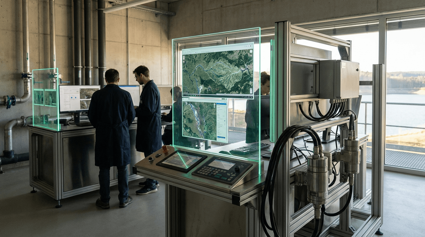
Water Security Intelligence represents a comprehensive approach to monitoring and managing transboundary water resources through the integration of satellite imagery, ground-based sensors, hydrological modeling, and data analytics. This technology addresses one of the most pressing geopolitical challenges of the 21st century: the equitable distribution and sustainable management of water resources that cross national boundaries. The system combines remote sensing capabilities—including synthetic aperture radar and multispectral imaging—with in-situ sensors that measure water levels, flow rates, chemical composition, and temperature across river basins, lakes, and underground aquifers. Advanced hydrological models process this data to create detailed representations of water availability, usage patterns, and quality metrics, while machine learning algorithms identify anomalies and predict future conditions. By providing a shared, objective view of water resources, these systems create a technical foundation for diplomatic negotiations and cooperative management frameworks that might otherwise be hampered by conflicting national assessments or limited monitoring capacity.
The geopolitical significance of this technology stems from its ability to transform water disputes from zero-sum conflicts into opportunities for cooperative resource management. Approximately 260 river basins and numerous aquifer systems cross international borders, affecting billions of people and representing potential flashpoints for regional instability. Traditional approaches to transboundary water management have often suffered from information asymmetries, where upstream nations control monitoring infrastructure and downstream nations lack visibility into water extraction or pollution. Water Security Intelligence systems address this challenge by providing independent, verifiable data that all stakeholders can access and trust. This transparency enables early detection of concerning trends—such as excessive upstream withdrawals, deteriorating water quality, or climate-driven changes in precipitation patterns—before they escalate into diplomatic crises or humanitarian emergencies. The technology also supports the implementation of international water treaties by providing the monitoring infrastructure necessary to verify compliance and trigger agreed-upon response mechanisms.
Several regional initiatives demonstrate the practical application of these systems, particularly in water-stressed areas where competition for resources intersects with existing geopolitical tensions. River basin organizations in regions such as the Nile, Mekong, and Indus watersheds have begun incorporating satellite-based monitoring and shared data platforms to support multilateral decision-making. International development organizations and research institutions are expanding access to these capabilities, recognizing that water security increasingly functions as a critical component of regional stability and economic development. As climate change intensifies water scarcity in many regions and population growth increases demand, the role of Water Security Intelligence in preventing resource conflicts and enabling adaptive management will become increasingly vital. The technology represents a convergence of environmental monitoring, diplomatic infrastructure, and conflict prevention, offering a pathway toward more resilient and equitable approaches to managing one of humanity's most essential shared resources.
Related Organizations

Independent institute for applied research in the field of water and subsurface.

A global research organization that spans more than 60 countries, with a major focus on land use, food, and forests.

A center of competence on hydropolitics and hydrodiplomacy attached to the University of Geneva.

A leading provider of global daily earth data, developing the Tanager hyperspectral satellite constellation.

A policy institute that facilitates water diplomacy and governance, focusing on transboundary water cooperation.

Global advisory and software company known for the MIKE suite of water modeling software.

Environmental intelligence company using satellite imagery and AI.

Applies satellite data and AI to monitor pipeline risk and dam integrity remotely.

Develops 'Lens', a platform that aggregates satellite data for monitoring environmental projects and water resources.

Supporting Evidence
Research this in Signals
Signals turns a topic into a sourced research record you can inspect and rerun. Your first scan is free, and this one starts with Water Security Intelligence already loaded, so edit it or scan as is.