Digital Matatu Transit Mapping and Payment
Geography: Emea · Africa · Africa
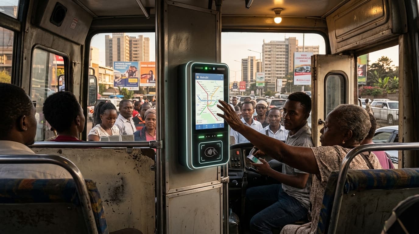
Nairobi's matatu system — privately operated minibuses that carry over 3 million passengers daily — was digitally mapped by the Digital Matatus project, creating the first comprehensive public transit map of an informal transport system. The open-source GTFS (General Transit Feed Specification) data has been integrated into Google Maps, enabling route planning for a system that has no official schedules, fixed stops, or central coordination. Cashless payment systems using NFC cards and mobile money are being deployed across the fleet.
The significance is methodological: Nairobi proved that informal transit systems — which carry the majority of urban passengers in African, Asian, and Latin American cities — can be digitized and optimized without formalization. The mapping technology used GPS-equipped smartphones carried by riders and crowdsourced data collection, producing transit data at a fraction of the cost of traditional transit surveys.
This approach has been replicated in Kampala, Dhaka, Manila, and Mexico City. The cashless payment integration goes further — by replacing cash transactions between passengers and drivers, it reduces robbery (a major problem), creates ridership data for route optimization, and enables transit subsidies to be targeted precisely. It's a template for bringing the 500+ million daily users of informal transit worldwide into the digital economy.