GPS-Denied Autonomous Underground Mining Systems
Geography: Americas · North America · Canada
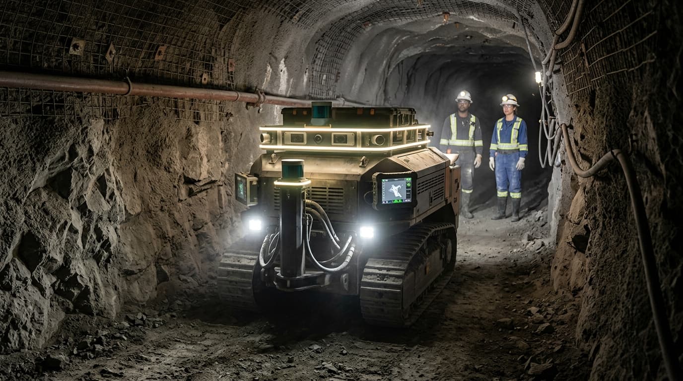
Canada's underground mining technology cluster, centred in Sudbury, Ontario, has produced a suite of autonomous systems purpose-built for GPS-denied environments: AI-powered collision avoidance (LoopX), LiDAR-based simultaneous localization and mapping (SLAM) for autonomous haulage trucks, robotic inspection drones that navigate pitch-dark drifts, and autonomous drilling systems that operate without human presence at the face. These technologies are validated in active underground mines — the world's only dedicated underground testbed operates in Sudbury, providing real-world conditions of variable rock, restricted ventilation, and narrow passages that surface labs cannot replicate.
GPS-denied autonomy is a fundamentally harder problem than surface autonomy. Underground, there is no GPS signal, no reliable wireless connectivity, and conditions of complete darkness, dust, and vibration that defeat conventional sensors. Canadian systems solve this through LiDAR-SLAM navigation fused with inertial measurement units, creating real-time 3D maps of mine environments that enable centimetre-accurate positioning without external infrastructure. LoopX's collision avoidance platform, developed in Sudbury and Waterloo, uses AI perception to detect workers and equipment in conditions where camera-based systems fail.
The strategic significance is that Canada's deep underground mining operations — extending to 3+ km depth — have created unique expertise in autonomous systems for extreme environments. This technology transfers directly to other GPS-denied domains: underwater robotics, tunnel construction, disaster response in collapsed structures, and military operations in dense urban environments or underground facilities. As global mining moves deeper and into more remote locations, Canadian GPS-denied autonomy technology becomes an increasingly valuable export.