
Envisioning is an emerging technology research institute and advisory.

LinkedInInstagramGitHub

2011 — 2026

research
  • Reports
  • Newsletter
  • Methodology
  • Origins
  • Vocab
services
  • Research Sessions
  • Signals Workspace
  • Bespoke Projects
  • Use Cases
  • Signal Scanfree
  • Readinessfree
impact
  • ANBIMAFuture of Brazilian Capital Markets
  • IEEECharting the Energy Transition
  • Horizon 2045Future of Human and Planetary Security
  • WKOTechnology Scanning for Austria
audiences
  • Innovation
  • Strategy
  • Consultants
  • Foresight
  • Associations
  • Governments
resources
  • Pricing
  • Partners
  • How We Work
  • Data Visualization
  • Multi-Model Method
  • FAQ
  • Security & Privacy
about
  • Manifesto
  • Community
  • Events
  • Support
  • Contact
  • Login
ResearchServicesPricingPartnersAbout
  1. Home
  2. Research
  3. Cities
  4. Spatial Computing

Spatial Computing

Blends digital content with physical spaces using sensors and computer vision for interactive 3D environments
Back to CitiesView interactive version

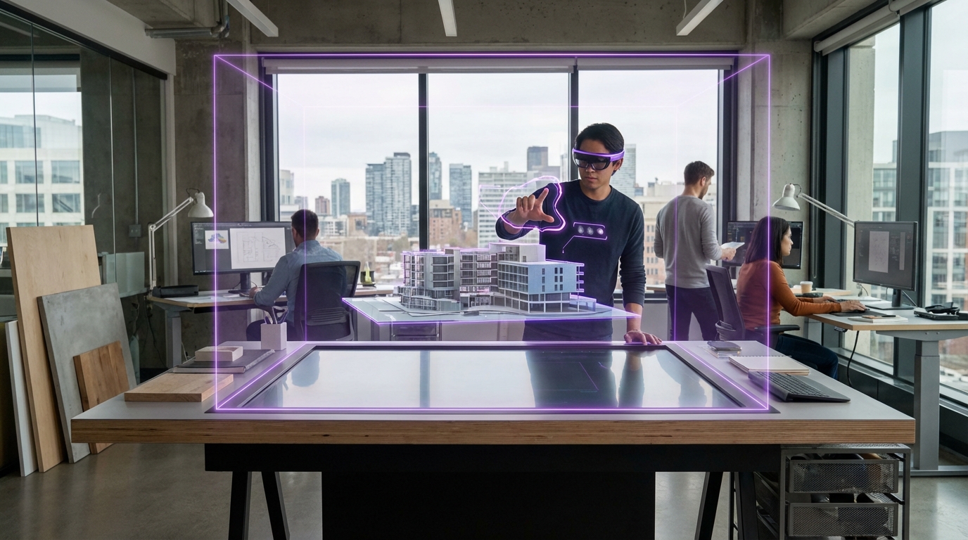
This solution integrates the physical and digital worlds, allowing for seamless interaction between humans, machines, and the three-dimensional space around them. At its core, Spatial Computing relies on the ability to perceive and understand the physical world through various sensors like cameras, 3D cameras, depth sensors, spatial trackers, and GPS, among others. These sensors capture real-time information about the surrounding environment, including the user's position, movement, and the objects and surfaces around the user. The captured data are then processed and analysed using computer vision algorithms and spatial mapping techniques to create a digital representation of the physical space. This digital representation, often called a spatial map or point cloud, allows the system to understand the geometry, layout, and characteristics of the real-world environment.

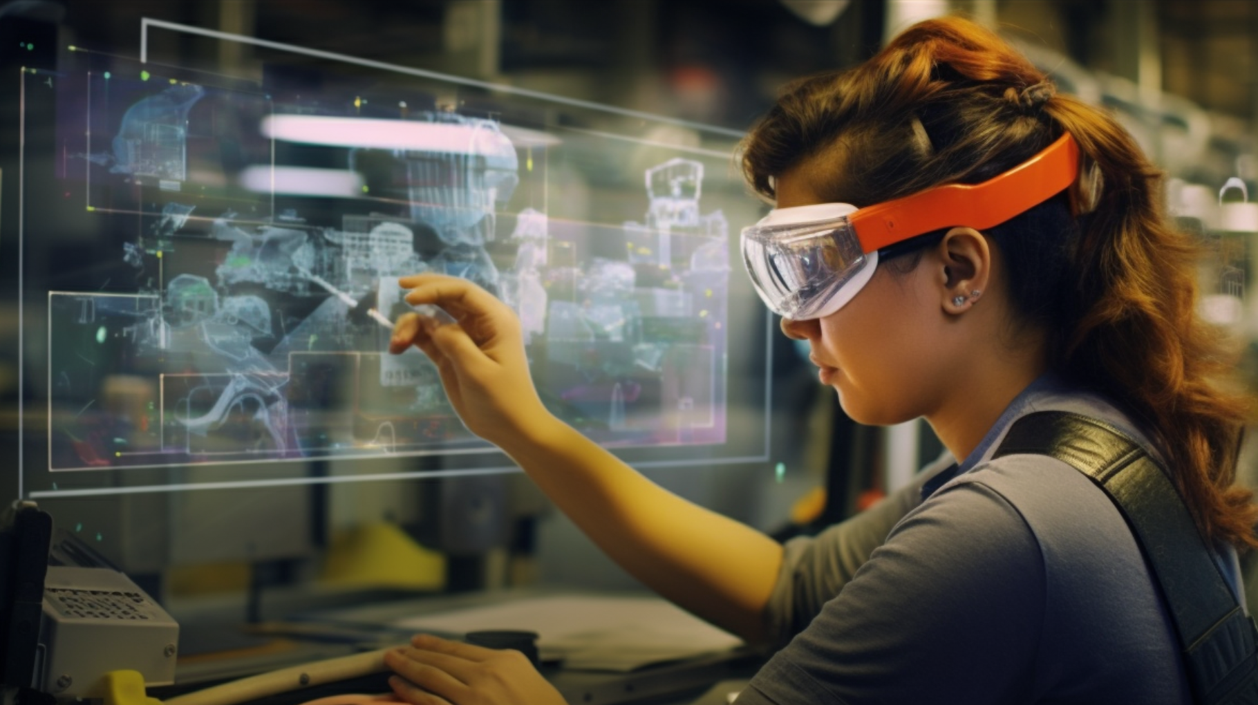
Once the digital representation of the physical space is established, Spatial Computing enables the seamless integration of virtual content into the user's perception of reality by digitally overlaying or replicating the surrounding area. This can be achieved through various display devices, such as head-mounted displays, smartphones, projection systems, specific controllers, and haptic devices.

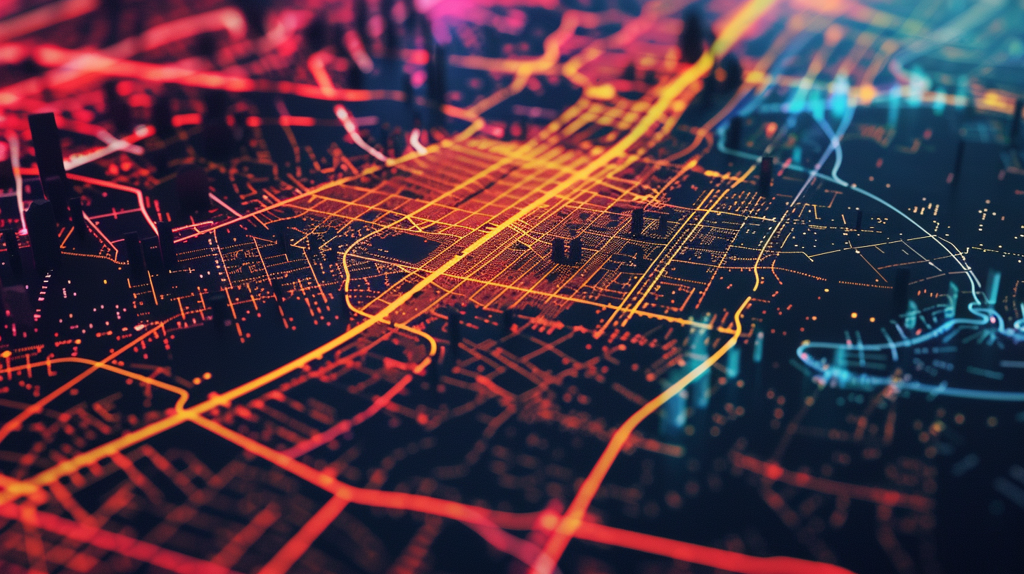
The primary appeal of spatial computing in urban contexts lies in its ability to manage and optimise space, a scarce resource in many cities. For instance, it can transform traffic management systems by predicting and alleviating congestion patterns, thus reducing commute times and carbon emissions. Similarly, in urban planning, spatial computing can simulate and visualise the impact of proposed buildings or infrastructures before they are constructed, ensuring optimal use of every square metre. This technology also supports emergency response units by creating more efficient routes and strategies in real-time, potentially saving lives during critical incidents.

Moreover, spatial computing facilitates a new level of interaction between city dwellers and their environment. Through augmented reality (AR) overlays, residents and visitors can receive real-time information about their surroundings, enhancing navigation and providing a richer experience of city life.

As urban populations continue to grow, the pressure on infrastructure and resources will intensify. However, with the advent of spatial computing, we have a powerful tool at our disposal. This technology offers a forward-thinking approach to these challenges, making it an essential component of smart city strategies. It not only promises to improve quality of life but also aims to make cities more sustainable and efficient. By integrating digital information with real-world elements, spatial computing holds the potential to transform urban areas into more livable, manageable, and engaging spaces, ushering in a new era of urban development.

Technology Readiness Level
8/9Ready for Implementation
Diffusion of Innovation
3/5Early Majority
Technology Life Cycle
2/4Growth
Category
Software

Related Organizations

Esri logo
Esri

United States · Company

95%

Global leader in GIS software (ArcGIS), providing the spatial analytics layer used by thousands of local governments for urban planning and policy.

Developer
NVIDIA logo
NVIDIA

United States · Company

95%

Developing foundation models for robotics (Project GR00T) and vision-language models like VILA.

Developer
Cesium

United States · Company

90%

Provides a platform for 3D geospatial data, enabling developers to stream real-world terrain into game engines like Unreal and Unity.

Developer
Hexagon AB logo

Hexagon AB

Sweden · Company

90%

A global leader in sensor, software, and autonomous solutions, providing reality capture for digital twins.

Developer
Matterport logo
Matterport

United States · Company

90%

Spatial data company that integrated mobile LiDAR support into their capture app, democratizing real estate digital twins.

Developer
Niantic logo
Niantic

United States · Company

90%

AR platform company that develops the Lightship ARDK and owns Scaniverse, a 3D scanning app leveraging LiDAR.

Developer
Bentley Systems logo
Bentley Systems

United States · Company

85%

Infrastructure engineering software company.

Developer
NavVis logo
NavVis

Germany · Company

85%

Provider of mobile mapping systems and reality capture software for indoor spatial intelligence.

Developer
Unity Technologies logo
Unity Technologies

United States · Company

85%

Provides the High Definition Render Pipeline (HDRP) which supports real-time ray tracing for gaming and industrial visualization.

Developer
Magic Leap logo
Magic Leap

United States · Company

80%

AR headset manufacturer utilizing dynamic dimming and eye-tracking for optimized rendering.

Developer

Supporting Evidence

Article

Urban visual-spatial intelligence: linking human and sensor perception for sustainable urban development

npj Urban Sustainability · Aug 12, 2025

Proposes 'Urban Visual-Spatial Intelligence' (UVSI) as a framework integrating human and sensor perception to enhance urban intelligence and support sustainable smart city development.

Support 95%Confidence 98%

Article

AI-driven real-time responsive design of urban open spaces based on multi-modal sensing data fusion

Scientific Reports · Nov 21, 2025

Demonstrates an AI-driven framework using multi-modal sensing (visual, acoustic, environmental) to create real-time responsive designs for urban open spaces.

Support 90%Confidence 95%

Paper

Reconstructing 4D Spatial Intelligence: A Survey

arXiv · Jul 28, 2025

Surveys the reconstruction of 4D spatial intelligence from visual observations, categorizing methods from low-level 3D attributes to dynamic scene interactions and physical constraints.

Support 88%Confidence 90%

Paper

Multimodal Spatial Reasoning in the Large Model Era: A Survey and Benchmarks

arXiv · Oct 29, 2025

Reviews advances in multimodal spatial reasoning using large models, covering tasks like 3D space grounding, scene layout understanding, and embodied AI.

Support 85%Confidence 90%

Paper

OKVIS2-X: Open Keyframe-based Visual-Inertial SLAM Configurable with Dense Depth or LiDAR, and GNSS

IEEE Transactions on Robotics · Sep 16, 2025

Presents a robust Visual-Inertial SLAM system capable of fusing LiDAR, depth, and GNSS data for high-accuracy mapping and state estimation.

Support 82%Confidence 75%

Article

Spatial Computing 101

blog.prototypr.io

Vision Pro gives us the possibility of injecting a middle-layer between ourselves and the always-changing dynamic reality. This can help us understand, interpret and react to the world — but we have yet to define new design patterns for it.

Support 50%Confidence 80%

Article

A New Definition of Spatial Computing: The Fourth Paradigm

infiniteretina.com

Welcome to the launch of our Spatial Computing Agency, Infinite Retina, which offers consulting services and research, a new video series, a new newsletter, a new podcast series, new industry databases (coming later this year), and a new book, coming in 2020. Along with our consulting services aimed at helping companies and entrepreneurs build new Spatial Computing projects and getting them funded and launched, we are very apt to helping everyone truly understand what the new paradigm of personal computing will be.

Support 50%Confidence 80%

Article

Spatial Computing and Social Media in the Context of Disaster Management

ieeexplore.ieee.org

The growing trend of using smartphones and other GPS-enabled devices has provided new opportunities for developing spatial computing applications and technologies in unanticipated and unprecedented ways. Some capabilities of today's smartphones highlight the potential of citizen sensors to enable the next generation of geoinformatics. One promising application area for this is social media and its application to disaster management. Dynamic, real-time incident information collected from onsite human responders about the extent of damage, the evolution of the event, the community's needs, and responders' ability to deal with the situation, combined with information from the larger emergency management community, could lead to more accurate and real-time situational awareness. This would enable informed decisions, better resource allocation and thus a better response and outcome to the total crisis. In this context, the US Department of Homeland Security's Science & Technology Directorate (DHS-S&T) has initiated the Social Media Alert and Response to Threats to Citizens" (SMART-C) program, which aims to develop citizen participatory sensing capabilities for decision support throughout the disaster life cycle via a multitude of devices and modalities. Here, the authors provide an overview of the envisioned SMART-C system's capabilities and discuss some of the interesting and unique challenges that arise due to the combination of spatial computing and social media within the context of disaster management.

Support 50%Confidence 80%

Article

Spatial Computing

techtarget.com

Spatial computing broadly characterizes the processes and tools used to capture, process and interact with three-dimensional (3D) data. Spatial computing is a technology defined by computers blending data from the world around them in a natural way.

Support 50%Confidence 80%

Article

XR and Spatial Computing

forbes.com

Support 50%Confidence 80%

Article

Working memory control dynamics follow principles of spatial computing

nature.com

Working memory (WM) allows us to remember and selectively control a limited set of items. Neural evidence suggests it is achieved by interactions between bursts of beta and gamma oscillations. However, it is not clear how oscillations, reflecting coherent activity of millions of neurons, can selectively control individual WM items. Here we propose the novel concept of spatial computing where beta and gamma interactions cause item-specific activity to flow spatially across the network during a task. This way, control-related information such as item order is stored in the spatial activity independent of the detailed recurrent connectivity supporting the item-specific activity itself. The spatial flow is in turn reflected in low-dimensional activity shared by many neurons. We verify these predictions by analyzing local field potentials and neuronal spiking. We hypothesize that spatial computing can facilitate generalization and zero-shot learning by utilizing spatial component as an additional information encoding dimension.

Support 50%Confidence 80%

Article

Transforming Smart Cities with Spatial Computing

ieeexplore.ieee.org

Spatial methods have a rich history of reforming city infrastructure. For example, John Snow’s 1854 London Cholera map spurred cities to protect drinking water via sewer systems and to increase green spaces for public health. Today, geospatial data and mapping are among the technologies that cities use the most due to strategic (e.g., long-term planning, land-use), tactical (e.g., property tax, site selection, asset tracking) and operational (e.g., E-911, situation awareness, gunshot location) use cases. Moreover, they (e.g., Google Maps) help citizens navigate, drones stay clear of restricted spaces (e.g., airports, NFL games), and sharing-economy (e.g., Uber) match consumers with nearby providers. Future spatial computing opportunities for smart cities are even more compelling. GIS promises to help re-imagine, redesign, see, and compare alternative infrastructure futures to address risks (e.g., climate change, rising inequality, population growth) and opportunities (e.g., autonomous vehicles, distributed energy production). This paper surveys recent spatial computing accomplishments and identifies research needs for smart-city use-cases.

Support 50%Confidence 80%

Article

IKEA's Journey Through 3D Visualization and Spatial Computing By Martin Enthed

youtube.com

This 30-minute presentation takes you on an enlightening journey through IKEA's innovative transformative use of 3D visualization and spatial computing, starting with IKEA's early adoption of AR and 3D modeling technologies. The talk highlights the challenges and vision that propelled their digital evolution. It underscores how these technologies have offered immersive and interactive experiences with products in a virtual environment. Delving into the technical aspects, it reveals the intricate processes behind creating IKEA's highly detailed 3D product models. The session concludes with a forward-looking perspective from IKEA's spatial computing team, exploring future possibilities and ongoing innovations in this field. This presentation not only showcases IKEA's current achievements in tech-driven retail but also offers a glimpse into the exciting, tech-forward future the company envisions, and the joint work with standards to reach it.

Support 50%Confidence 80%

Same technology in other hubs

Horizons
Horizons
Spatial Computing

Digital systems that map and interact with physical 3D environments in real-time

Connections

Applications
Applications
AR Workforce Assistance

Overlays digital instructions and data onto workers' field of view via smart glasses or mobile devices

Technology Readiness Level
7/9
Diffusion of Innovation
2/5
Technology Life Cycle
2/4
Software
Software
Web GIS

Browser-based mapping and spatial analysis for urban planning, infrastructure, and disaster response

Technology Readiness Level
9/9
Diffusion of Innovation
4/5
Technology Life Cycle
3/4

Book a research session

Bring this signal into a focused decision sprint with analyst-led framing and synthesis.
Research Sessions