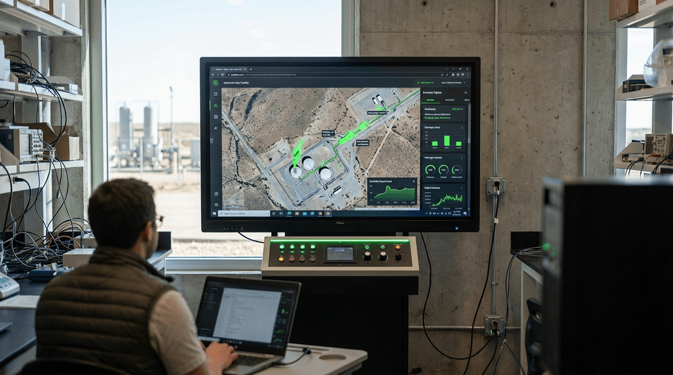
Satellite Methane Monitoring
Methane, a greenhouse gas with a warming potential over 80 times greater than carbon dioxide over a 20-year period, represents one of the most pressing challenges in the energy sector's transition toward sustainability. Natural gas infrastructure—spanning millions of kilometres of pipelines, compressor stations, storage facilities, and processing plants—is particularly vulnerable to leaks that can go undetected for extended periods. Traditional ground-based inspection methods, including manual surveys with handheld detectors and periodic aerial surveys, are labour-intensive, costly, and often miss intermittent or hard-to-access emission sources. Satellite methane monitoring addresses these limitations by deploying constellations of Earth-observation satellites equipped with advanced spectrometers capable of detecting methane's unique spectral signature in the shortwave infrared range. These instruments measure the absorption of sunlight as it passes through the atmosphere, identifying methane concentrations with spatial resolutions now reaching as fine as 20-30 metres in some systems, allowing operators to pinpoint leak locations along vast pipeline networks with unprecedented accuracy.
For gas utilities and energy companies facing increasingly stringent regulatory frameworks and public pressure to reduce emissions, satellite monitoring transforms methane management from a reactive to a proactive discipline. The technology enables continuous, wide-area surveillance that would be economically unfeasible through conventional means, particularly for infrastructure in remote or difficult terrain. When a satellite detects an anomalous methane plume, operators receive alerts with geospatial coordinates, emission rate estimates, and often historical trend data, allowing maintenance teams to prioritise repairs based on leak severity. This capability directly addresses the industry's "super-emitter" problem, where a small percentage of leaks account for the majority of total methane emissions. Early deployments indicate that satellite-detected leaks, when rapidly addressed, can reduce facility-level emissions by 40-60 percent. Beyond operational benefits, this monitoring provides verifiable emissions data that utilities can use to demonstrate compliance with regulations, support carbon credit programs, and build stakeholder confidence in their environmental commitments.
Commercial satellite methane monitoring services have expanded rapidly since the late 2010s, with multiple providers now offering regular coverage of major oil and gas producing regions. Some utilities have integrated satellite data into their leak detection and repair programs, combining space-based alerts with ground-based verification and repair workflows. The technology is particularly valuable in regions with aging infrastructure or areas where pipeline networks cross challenging geography. As satellite sensor technology continues to advance—with next-generation systems promising daily global coverage and improved detection sensitivity—this approach is becoming integral to the natural gas industry's methane mitigation strategies. The convergence of satellite monitoring with artificial intelligence for automated plume detection and the growing availability of high-resolution data suggests that comprehensive, transparent methane accounting across entire gas distribution networks will soon become standard practice, fundamentally reshaping how the industry manages its environmental footprint and maintains its social license to operate during the energy transition.
Related Organizations

A global NGO that incubated MethaneSAT and conducts extensive scientific research on methane leaks in the oil and gas supply chain.

Specializes in high-resolution remote sensing of greenhouse gas emissions from space.

A subsidiary of the Environmental Defense Fund launching a satellite to locate and quantify methane emissions globally.

Non-profit organization leading a public-private partnership to deploy satellites detecting methane and CO2 point sources.

Leads the EAGLE-1 mission and the SAGA program to build a European quantum communication infrastructure in space.

Environmental intelligence company using satellite imagery and AI.

Conducts advanced demonstrations like LCRD (Laser Communications Relay Demonstration) and DSOC (Deep Space Optical Comm).

Provides space-based hyperspectral monitoring solutions, focusing on energy infrastructure and environmental compliance.

A leading provider of global daily earth data, developing the Tanager hyperspectral satellite constellation.
UN Environment Programme (UNEP)
Kenya · Government Agency
Hosts the International Methane Emissions Observatory (IMEO), which integrates satellite data to verify company reporting.